by Klau Geomatics | Feb 27, 2019 | Press release
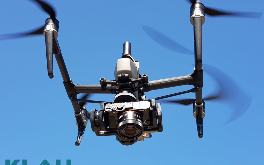
With the end of the DJI X4s camera, drone operators have been looking for a quality mapping camera solution for the Inspire 2 and M200/M210/M210V2 drones. Klau Geomatics has released a Sony camera/PPK payload to offer even better results from these drones. This...
by Klau Geomatics | Feb 27, 2019 | Press release
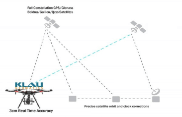
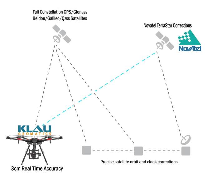
Klau Geomatics, established a leader in UAV PPK solutions, has released another breakthrough in survey technology for drones and manned aerial mapping: Real-Time PPP (Precise Point Positioning), enabling 3 to 5cm initial positioning accuracy, anywhere in the world,...
by Klau Geomatics | Feb 11, 2019 | Press release
Klau Geomatics has released Real-Time Precise Point Positioning (PPP) for aerial mapping and drone positioning that enables 3 to 5 cm initial positioning accuracy, anywhere in the world, without any base station data or network corrections. With this, you Just need to...
by Klau Geomatics | Dec 13, 2018 | Testimonials
The accuracy of the Klau PPK Module exceeds expectations every time. I have performed some checks using a surveyor’s Total Station against the results from the Klau PPK Module, and if the flight is done at low altitude and with a large overlap, the accuracy on any...
by Klau Geomatics | Nov 27, 2018 | Press release
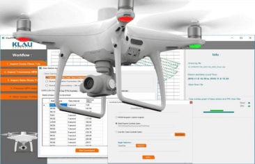
Klau Geomatics, industry leader in PPK hardware and post-processing software, announced today its new PPK software for the DJI Phantom4 RTK drone. The software enables professional users to achieve the most accurate and reliable results with their P4RTK drone without...

Recent Comments