KlauPPK: Central to Accuracy in Open UAV Ecosystem

KlauPPK has been the go-to product for survey accuracy on drones since 2015. Now, as the industry starts to move away from the DJI monopoly to a more open architecture, the KlauPPK hardware and software solutions are an even more powerful component to bringing best-of-breed technologies together.
The UAV sector has fallen into this love/hate relationship with DJI. Yes, we love the technology, the features, how they are shiny and powerful out of the box. This is shown by their 80% market capture, an almost-monopoly that seemed destined to consume the world. Like Apple, who closed their system, using only their own hardware, software and services, DJI have guided a passionate following to come into their world where they have everything you need; the drone, the sensors, the data platform for analytics. Why go anywhere else?
Not everyone is looking for this contained prescribed product. US Agencies have banned the use of Chinese drones in the current trade war. Corporates don’t typically like having their data sent back to the drone manufacture, regardless of if they chose to use their analytics platform or not. Professionals, such as surveyors, require hands on control of their data and processes, not necessarily committing their professional licence and reputation to a black box solution.
We are seeing a more democratised open architecture model emerge that allows the best of breed to come together to produce extremely high spec-technology customised for specific requirements.
ArduPilot has been working in this space since 2007, with software to control drones before we even knew words like drone, UAV, UAS and RPAS. Hardware such as the open source Pixhawk PX4 are the basis of many non-DJI drones. With the Mavlink standard, external hardware devices can be integrated, such as a wide variety of quality cameras and sensors.
The opportunity has never been greater for ‘open’ systems to shine.
For survey grade accuracy on UAVs and manned aircraft, Klau Geomatics is established as the quality product, high spec hardware and sophisticated software designed and built by surveying professionals and academics.
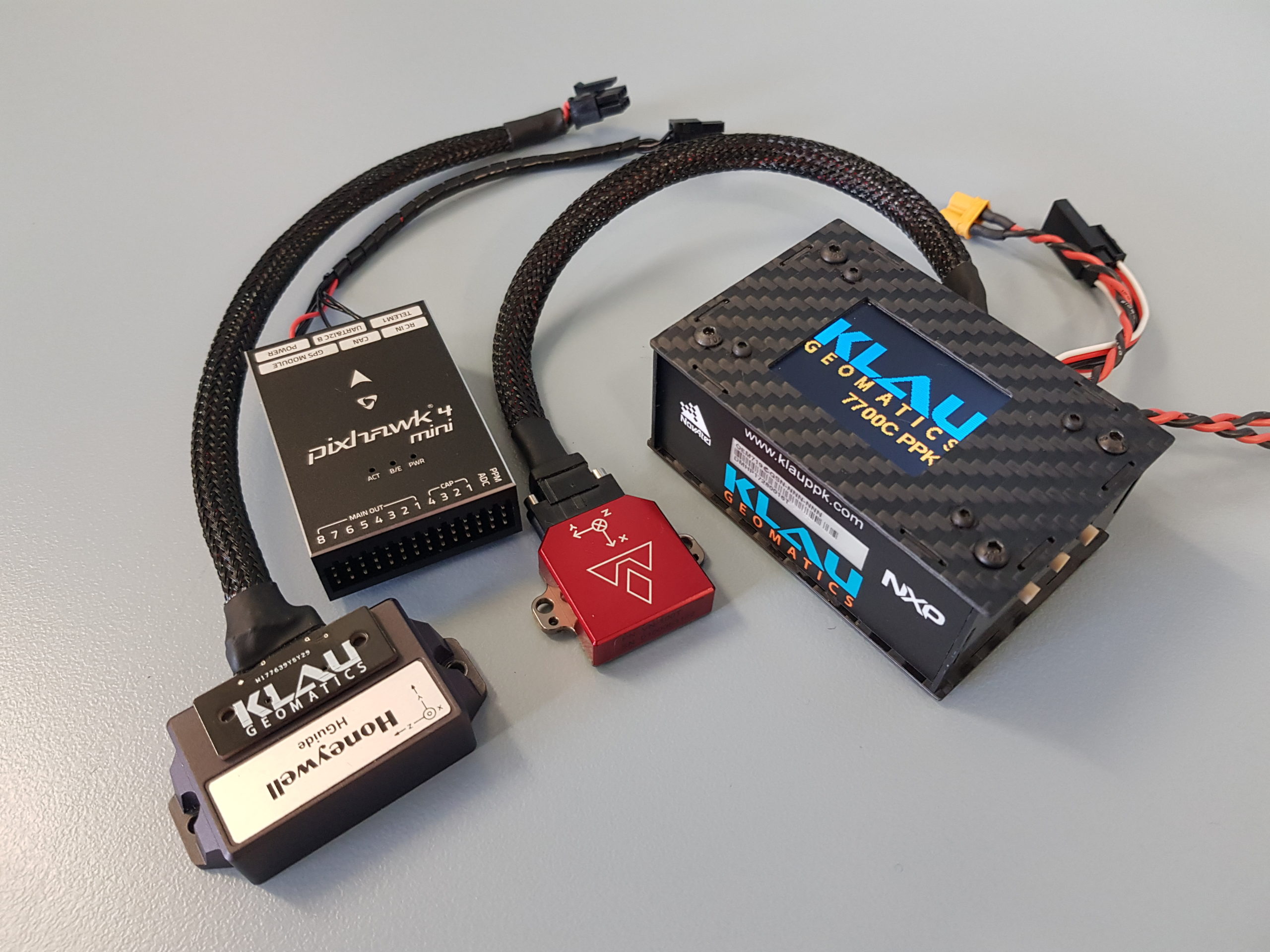
KlauPPK hardware is designed to integrate with external devices such as IMUs and LiDAR. Connect a KlauPPK module to an INS or IMU (Pixhawk, Honeywell, KVH, VectorNav and others to come) and the unit will handshake, set up configuration on the IMU and log the aircraft tilts or raw IMU data for post processing. The data is logged onboard the KlauPPK with the raw GNSS data from the internal NovAtel 7 series board.
The KlauPPK hardware connects to cameras (DSLR, PhaseOne, Hasselblad…) to trigger the camera by user-defined distance and capture the precise centre of exposure timing. Plug and play precision.
For Pixhawk (or similar) drone manufacturers, the KlauPPK will automatically log drone tilts to compute the precise camera position relative to the GNSS antenna. The autonomous position from the KlauPPK can also be used by the flight controller, which can be sub- 0.1m accuracy with TerraStar real time PPP.
The GNSS and attitude data logged on the KlauPPK hardware in a typical photogrammetry capture can be processed in the KlauPPK software to produce highly accurate camera centre coordinates in any published system or with a localisation applied.
No base station? No worries! The PPP NRT post processing solution applies precise satellite clock and orbit data and up to 15 distant CORS stations to achieve very high PPK/PPP absolute accuracy on kinematic GNSS data. This post processing system is tuned to get the most out of the professional grade GNSS hardware in the KlauPPK system, something that can’t be achieved with DJI hardware.
Working with LiDAR on your drone? KlauPPK will integrate with the IMU of your choice, to match the accuracy requirements and budget of your system. A signal from the KlauPPK to the LiDAR will keep the data synchronised for post processing. A lightweight LiDAR logging device is also available from Klau Geomatics to complete the acquisition system on a drone.
GNSS and IMU data can be post processed with the Klau Geomatics cloud service to provide tightly coupled Kalman Filtered results of the trajectory and orientation, to apply to the LiDAR data. This too can be done with PPP NRT for high accuracy without the typical base station range issues. With highly accurate data inputs, your LiDAR is less dependent on ground targets for point cloud registration.
So, its not about defined end-to-end solutions, but independent agnostic components that can be integrated into custom systems. UAV manufacturers can integrate their drone with their choice of components, with KlauPPK to communicate with the devices and aggregate the data to suit the accuracy requirements.
As the UAV market trends towards more open systems, Klau Geomatics is focused on supporting OEM manufacturers and integrators with everything they need for accuracy.
Want to find out more? Get in touch by clicking here, or email contact@geomatics.com.au
