by Klau Geomatics | Jun 20, 2019 | Press release
UAVs have brought photogrammetry back as a bread and butter tool for surveying. They’ve put mapping back on the map. But often we see large ambitious UAV projects undertaken, to capture long stretches of highway or vast expanses of detailed mapping, taking weeks of...
by Klau Geomatics | Feb 27, 2019 | Press release
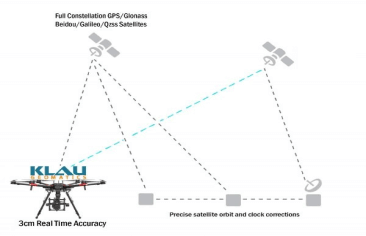
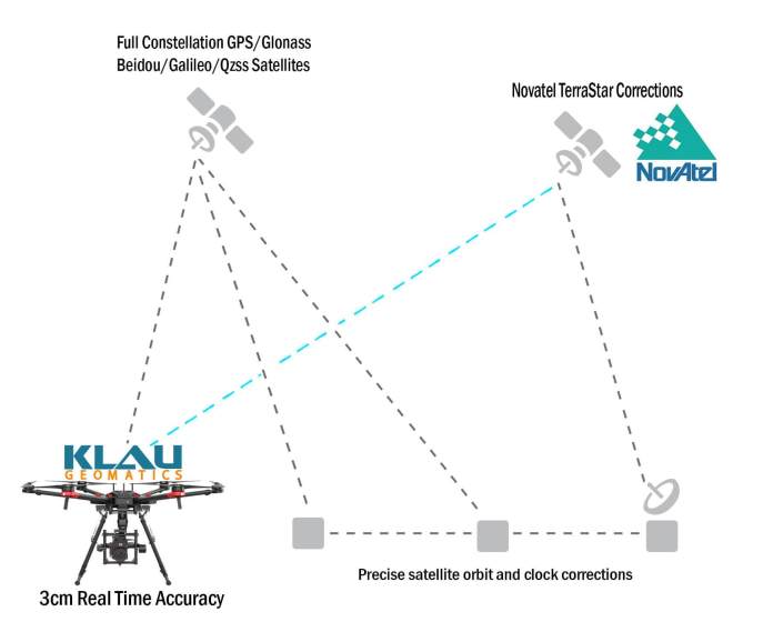
Klau Geomatics, established a leader in UAV PPK solutions, has released another breakthrough in survey technology for drones and manned aerial mapping: Real-Time PPP (Precise Point Positioning), enabling 3 to 5cm initial positioning accuracy, anywhere in the world,...
by Klau Geomatics | Feb 27, 2019 | Press release
With the end of the DJI X4s camera, drone operators have been looking for a quality mapping camera solution for the Inspire 2 and M200/M210/M210V2 drones. Klau Geomatics has released a Sony camera/PPK payload to offer even better results from these drones. This...
by Klau Geomatics | Feb 11, 2019 | Press release
Klau Geomatics has released Real-Time Precise Point Positioning (PPP) for aerial mapping and drone positioning that enables 3 to 5 cm initial positioning accuracy, anywhere in the world, without any base station data or network corrections. With this, you Just need to...
by Klau Geomatics | Nov 27, 2018 | Press release
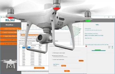
Klau Geomatics, industry leader in PPK hardware and post-processing software, announced today its new PPK software for the DJI Phantom4 RTK drone. The software enables professional users to achieve the most accurate and reliable results with their P4RTK drone without...
by Klau Geomatics | Aug 7, 2018 | Press release
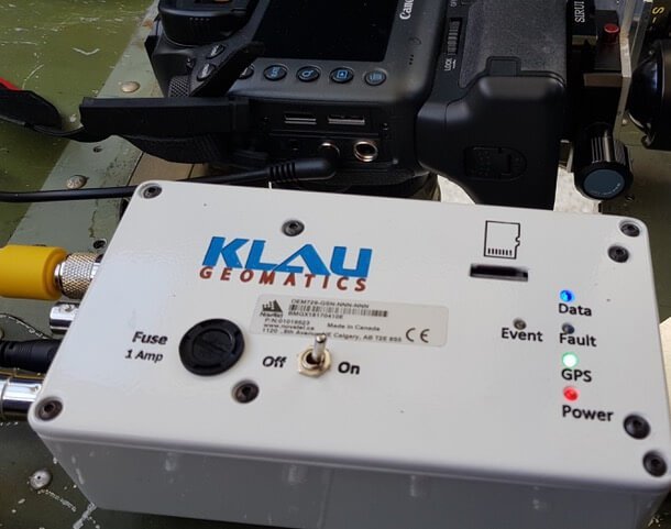
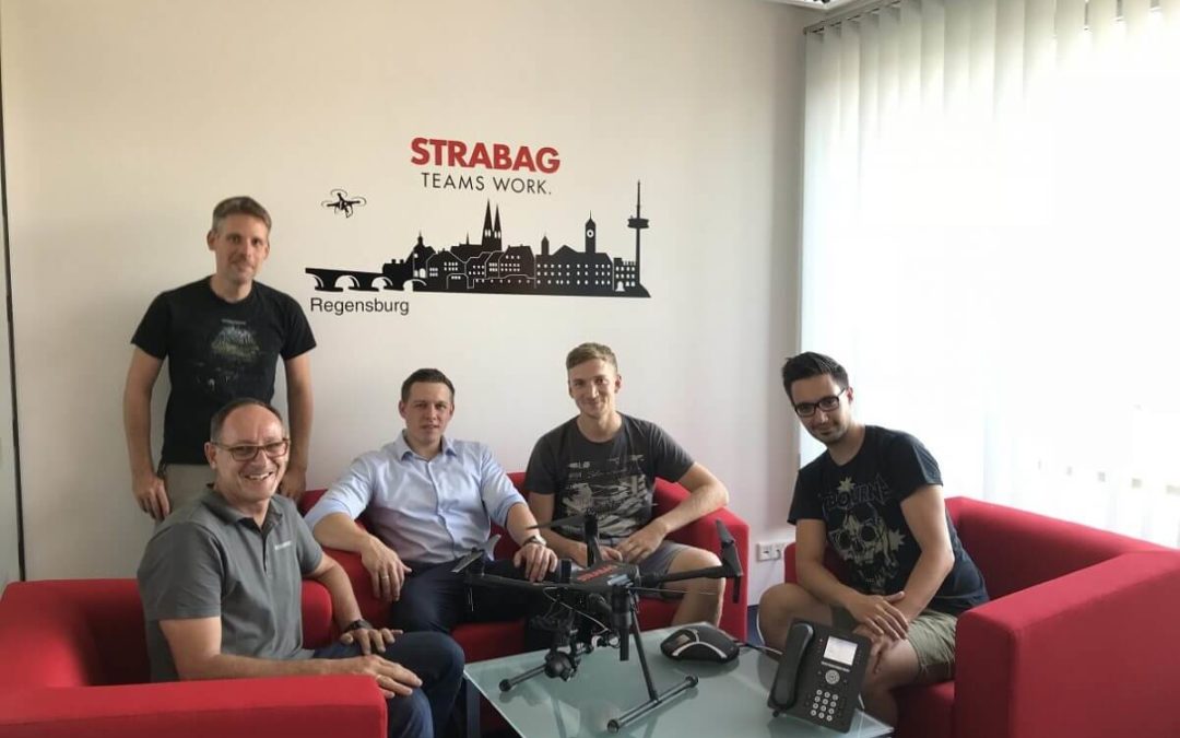
STRABAG is a European tech company for construction services with about 73.000 employees worldwide. In early August, the first KlauPPK system was delivered to STRABAG‘s department “Digital Object Scanning and Drones”, by Videographics Ingenieurgesellschaft mbH as a...

Recent Comments